


 24/7 Emergency Service
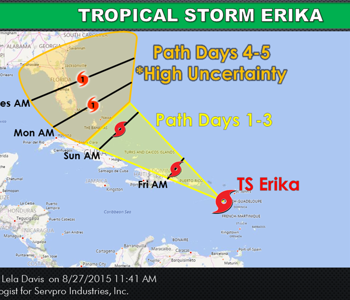
Tropical Storm Erika
8/27/2015 (Permalink)
TROPICAL STORM ERIKA:
Hurricane Hunters investigated Tropical Storm Erika this morning and determined the strength, as far as minimum surface pressure, is about the same but she is not very organized. The showers associated with Erika are displaced south of the center of the low pressure, which means Erika is more exposed to weakening. The next couple of days will be tough on Erika due to strong vertical wind shear (winds increasing with height). If Erika can withstand the battering over the next couple of days, she will likely stay on the path further to east, just off the coast of Florida. If Erika dramatically weakens, the path will steer more westward, heading directly towards Florida but the system will be much weaker. As we approach the beginning of next week, Erika will slow down which could still bring high rainfall totals to Florida and the Carolinas. Erika is also going to be impacted by the high pressure that has taken up residence in the central Atlantic. The forecast models always have a hard time determining how much the outskirts of the ridge of high pressure will weaken over time, which affects the path of tropical cyclones. Tropical systems always go around a high pressure (low pressure never moves towards high pressure).
Please continue to keep in mind the media has a tendency to focus in on the most devastating forecast path in order to increase their ratings, even if this is not the most probably path.